I hold an MA and PhD from the University of Wisconsin-Madison, where I learned how to reconstruct the past from disparate and fragmentary evidence.
I can carefully reason my way through voluminous records and
data.
I can recognize source biases, reconcile contradictions, and
use those findings to produce compelling factual narratives.
👇 Scroll down to see recent projects on which I've applied these skills 👇
2024
Doctoral Research in History
Using local newspapers and economic data to reconstruct the history of Davao City, Philippines (1980-1998)
Summary
Drawing on a newly digitized collection of more than 200,000 pages of
local newspapers, my PhD dissertation narrated the story of how Davao
City, the third-largest city in the Philippines, shed its 1980s-era
reputation as "Murder City" and became the hub of economic investment
in the southern Philippines.
For academic audiences, the project's primary value is that it adds a wealth of new material
to the literatures on recent economic and urban history in the Philippines,
helping to expand the scholarly view beyond Metro Manila. More broadly,
the project also political scientists and journalists significantly more context and detail
about the backstory of former President Rodrigo Duterte.
Secondarily, the project is a case study for affordable and research-driven
digitization. See more at The Davao Newspaper Library.
Details
The idea for the project emerged while conducting interviews in Metro Manila
for a short documentary about the national drug war in early 2017.
I abandoned the film project when I realized that the contemporary political
issues I was learning about had deep historical roots, many of which
began in Davao City in the 1980s.
Between 2018 and 2023, during breaks in coursework, I
conducted roughly 18 months of fieldwork in the Philippines. I conducted archival
research in 12 different archives, conducted more than four dozen
background interviews, and digitized more than 220,000 pages of
local newspapers. These sources produced a detailed narrative describing
Davao City's descent into political disorder in the early 1980s,
the end of the security crisis by 1986, and the emergence of a new
political and economic order under former Mayor Duterte in the 1990s.
I successfully defended the dissertation in May 2024.
The project was awarded financial support by:


2022
Investigative Journalism
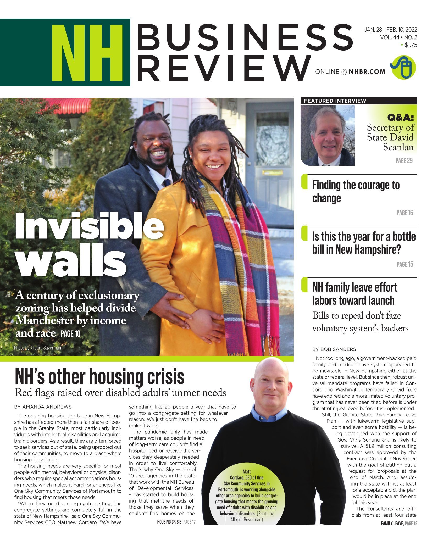
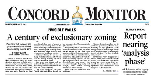
Using historical zoning maps, local history, and demographic data to examine housing discrimination in Manchester, New Hampshire (USA)
Summary
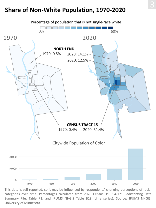
In mid-2021, as a housing crisis made headlines across New Hampshire, the Granite State
News Collaborative launched a six-month investigation to examine why so much of the state's
poverty and racial diversity had long been concentrated in a single neighborhood in
the city of Manchester.
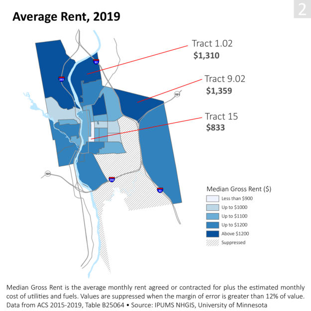
Through a novel combination of newly-digitized zoning maps, public reports,
and industrial histories, the research revealed that more than a hundred years of
specific and discriminatory local housing policies had intentionally
corralled the city's poorest residents into these neighborhoods.
As the city's population became more racially diverse in the late 20th century, these
neighborhoods became both disproportionately poor and non-white.
Details
I conceptualized the series, working with editors from the
Collaborative, NH Business Review, and Business NH Magazine.
Early interviews pointed us toward the history of land use
zoning, but we quickly realized that little info was available
on this topic.
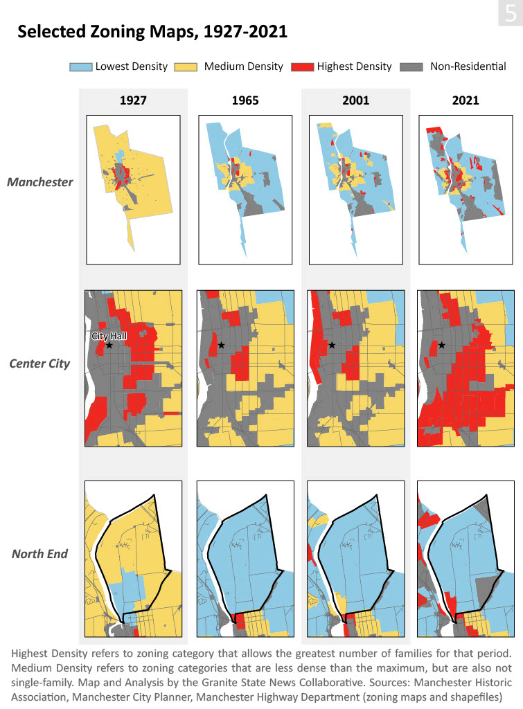
In fall 2021, I created a novel spatial dataset by georeferencing
and overlaying all of the city's surviving zoning maps dating back to 1929,
when the first map was approved. Using this dataset, we were
able to show that the areas in the city that suffered from chronic high
poverty and high crime today had been consistently targeted
by zoning for high-density housing, while wealthier
neighborhoods were reserved for single-family homes.
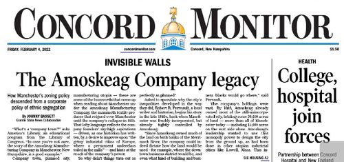
To convey our research to the public, I wrote a
three-part story that presented these findings as part of a 180-year
history. I showed that the city's present-day economic segregation
actually began with the mill company that lorded over Manchester
for the city's first 100 years, but that starting in the 1920s
these patterns of discrimination were reinforced by land use
zoning.
2023 Public Occurrences Award Winner

Recognizing "the very best work that New England newspapers produce each year"
Selected Reprints:

Interviews:

Selected graphics:
2021
Investigative Journalism
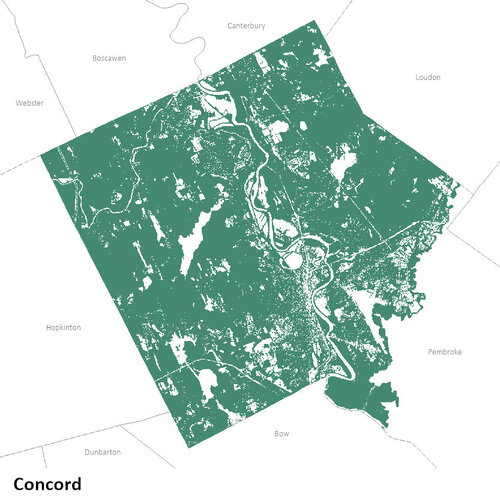
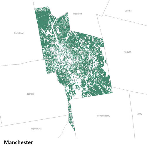
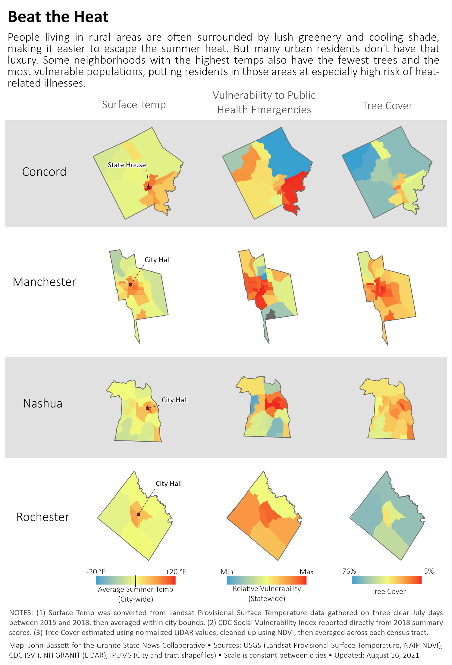
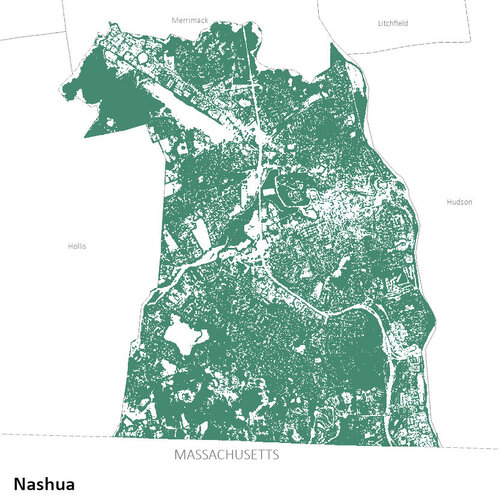
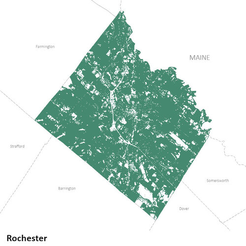
Using public LiDAR and satellite data to estimate urban tree cover in four New Hampshire cities
Summary
In the summer of 2021, the New Hampshire Bar News and the
Granite State News Collaborative surveyed the factors impacting
heat-related illness across the state, bringing together
traditional reporting with data journalism.
To estimate the tree canopy coverage of New Hampshire cities,
a data layer that was not yet publicly available, I adapted
a workflow developed by the Spatial
Analysis Lab at the University of Vermont.
Details
After my editor and fellow journalist identified urban tree cover as one of the primary factors affecting local temperatures, I began trying to source tree canopy GIS layers for NH. After speaking with several state and federal officials, however, I realized that these layers did not exist.
We solved this problem by adapting a workflow developed by
the University of Vermont’s Spatial Analysis Lab. Their analysis
used LiDAR data to identify objects on the ground,
then Normalized Difference Vegetation Index (NDVI) data
to identify which of those objects were plants (based on the
energy wavelengths the object absorbed and reflected). Objects
that were plant-like and above a given height threshold were
classified as plants.
Our layer identifies most trees in each city, but because we
were unable to implement some of the more sophisticated calculations
suggested by the UVM researchers, there
are still some errors (e.g., trees that we’ve missed, or
other objects that we’ve accidentally labelled as trees).
This made the dataset useful for seeing
patterns at the level of the city or neighborhood, but not
for more granular analysis.
Selected graphics: